Weather Maps of Mexico Storms
Thursday, February 18th, 2010 at 4:29 pm by Jim LovettFiled under Mexico | Comments Off on Weather Maps of Mexico Storms
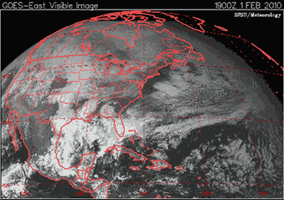
Satellite imagery of the track of the moisture-laden system that moved through central Mexico 1-5 February:
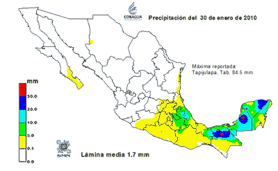
Precipitation 30 January – 5 February (for reference, 50 millimeters is approximately 2 inches):
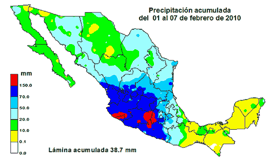
Total Precipitation 1-7 February (for reference, 150 millimeters is approximately 6 inches):


Sorry, comments for this entry are closed at this time.